Chimpman’s Known World 1000 BC, 24 miles per hex v1
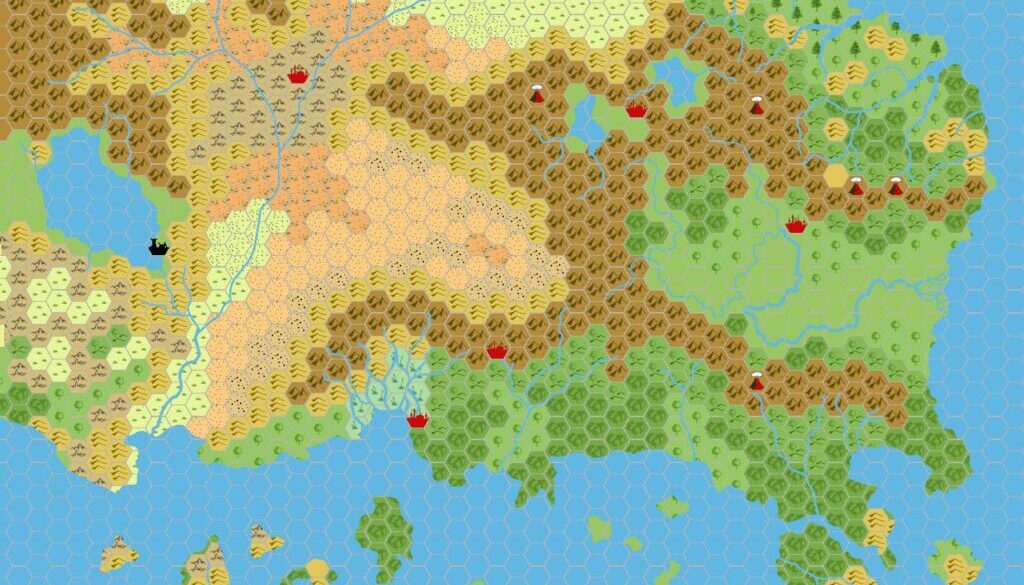
In late September 2008, John Calvin shared the first of what would come to be an amazing series of historical maps of the Known World. Although he later focused primarily on the 2300 BC period, he actually began a little closer to the present day, in 1000 BC — the heyday of the Nithian Empire.
In his post at The Piazza, John explained the reasoning behind the choices in this map:
The coastal lines should be similar to the current day Known World, however there are some major differences:
- The climate zones are different, with the major example being that Nithia becomes a lush temperate zone, and Alfheim a desert.
- I think it’s also likely that the course of rivers may have changed over 2000 years.
- The original Atruaghin plateau was destroyed circa 1700 BC. I’m not sure what it should be replaced with, but for now I’m postulating broken/rugged terrain.
- It’s roughly 700 years since a devastating explosion was triggered by a group of elves in the Broken Lands. I’m not sure how much damage that would have done to neighboring lands or how long it would take for nature to repair itself, but I’ve extended the desolation of the Broken Lands in this map.
He went on to explain the “tentative” capitals marked on the map:
- Ranak – According to HWR2 Ranak was the capital on the outer world as well as in the hollow world (for a time). Placement is uncertain.
- Oenkmar – The humanoids found (and took) the city in 1190 according to GAZ10
- Lost Valley – Although I don’t really think that this would be the seat of Hutaakan power in the area, for now it’s just a placeholder to remind me they are there.
- Halag – I don’t like the size of the swamp near Halag but haven’t gotten around to changing it yet.
- Dengar – The dwarves have been in Rockhome (in some form or fashion) for at least 1500 years at this point.
Just a couple of days later he would make a revised version to tweak the terrain and capital locations.
Fan-made Map by John Calvin (September 2008)
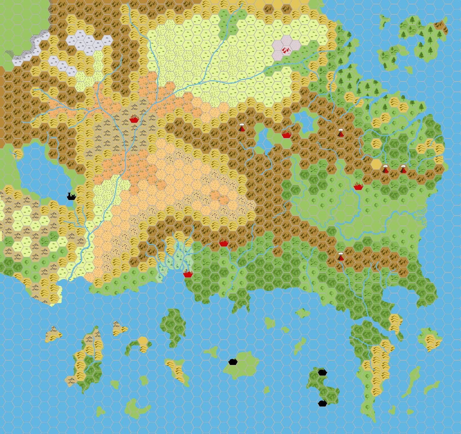
This is an original map created by one of Mystara’s excellent fan cartographers. For more information on the cartographer, including a gallery of all their maps, see also Appendix M: Mappers of Mystara.
Sources
- B10 Night’s Dark Terror (1986) (PDF at DriveThruRPG)
- GAZ5 The Elves of Alfheim (1988) (PDF at DriveThruRPG)
- GAZ6 The Dwarves of Rockhome (1988) (PDF at DriveThruRPG)
- GAZ10 The Orcs of Thar (1989) (PDF at DriveThruRPG)
- Hollow World Campaign Set (1990) (PDF at DriveThruRPG)
- HWR2 Kingdom of Nithia (1991) (PDF at DriveThruRPG)
Fan Sources
- ?
References
- All of John’s maps at the Atlas of Mystara
- John’s entry in Appendix M: Mappers of Mystara (upcoming)
- John’s author page at the Vaults of Pandius
Chronological Analysis
This is a fan-made map. It was published in September 2008. The updated Atlas version of this map is not yet available. See also Appendix C for annual chronological snapshots of the area. For the full context of this map in Mystara’s publication history, see the upcoming Let’s Map Mystara 2008.
The following lists are from the Let’s Map Mystara project. Additions are new features, introduced in this map. Revisions are changes to previously-introduced features. Hex Art & Fonts track design elements. Finally, Textual Additions are potential features found in the related text. In most cases, the Atlas adopts these textual additions into updated and chronological maps.
Under Construction! Please check back again soon for updates.